Frassenaye waterfall
Sport, Pedestrian sports, Hiking itinerary
in Val-d'Illiez
9.0
km
-
Loop from the village of Val-d'Illiez to the magical Cascade de Frassenaye, with several glimpses of the Dents Blanches and Dents du Midi.
-
Val-d'Illiez - Pro Deforan - Cascade de Frassenaye - Draversat - La Cour - Val-d'Illiez
From the square in front of the Val-d'Illiez church, take under the train track down the Chemin de la Creuse, then go to the right onto the Route de Fellina. Follow the sentier des Champs down to the river La Vièze. Cross the bridge and follow the signposts on the path up to the Pro Déforan chalets.
Cross the Route des Rives* and climb towards Soi, taking in the view of the Dents Blanches, as far...Val-d'Illiez - Pro Deforan - Cascade de Frassenaye - Draversat - La Cour - Val-d'Illiez
From the square in front of the Val-d'Illiez church, take under the train track down the Chemin de la Creuse, then go to the right onto the Route de Fellina. Follow the sentier des Champs down to the river La Vièze. Cross the bridge and follow the signposts on the path up to the Pro Déforan chalets.
Cross the Route des Rives* and climb towards Soi, taking in the view of the Dents Blanches, as far as the junction with the forest road (route de Soi), the highest point of the walk.
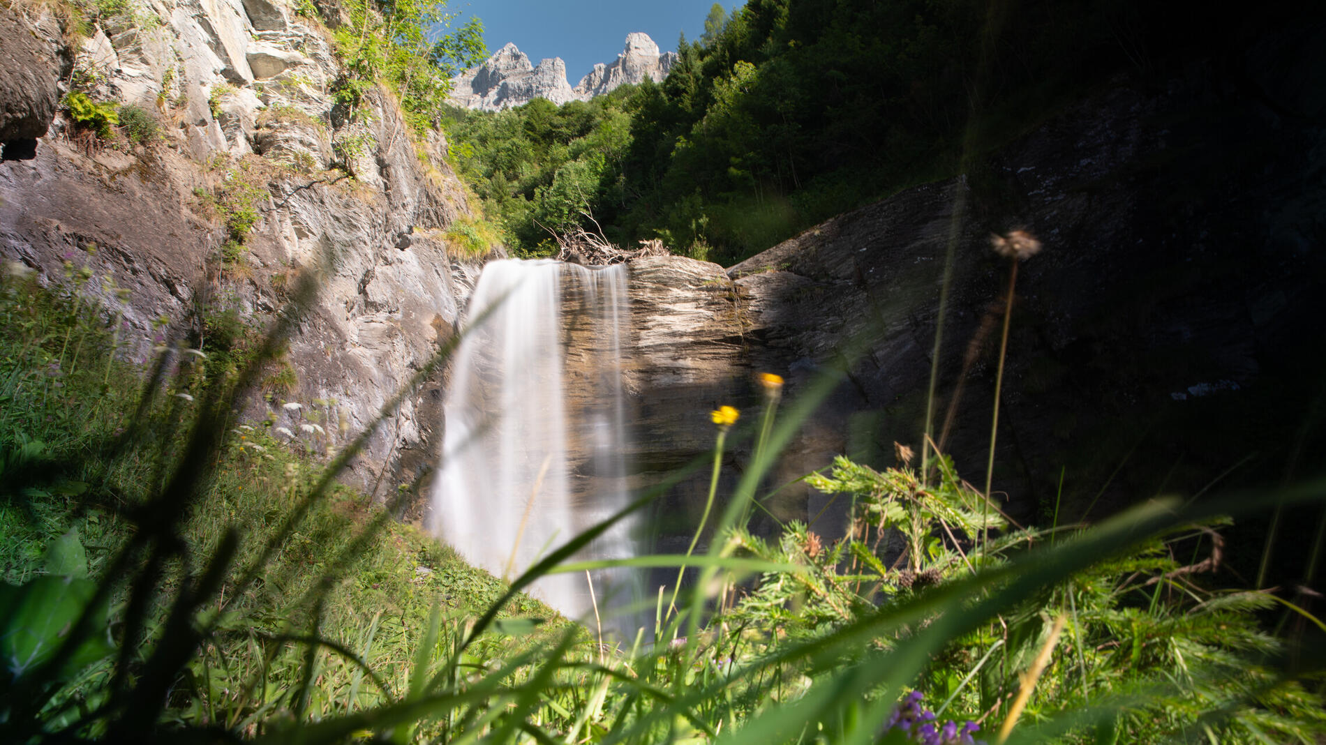
Descend to the magical Cascade de Frassenaye, overlooked by the Haute Cime and Les Doigts peaks.
After a well-deserved break, walk down along the river (to the Route des Rives and pass under the water reservoir) and join the Route de Chetel, which descends to the Draversat bridge**. Walk up the Route des Combes and Play to reach back the centre of the village of Val-d'Illiez.
VARIANTS :
*if you don't want to climb further, you can follow the Route des Rives as far as Plan Soi (hairpin bend, yellow Cascade de Frassenaye footpath sign).
**Variant for the return way: turn right before the Draversat bridge, walk along the Vièze river on a wilder path as far as the first bridge on the outward journey (at the bottom of the Chemin de Lachat) and go back up the Sentier des Champs (or take a break at the Tennis restaurant).
- Departure
- Val-d'Illiez
-
-
PARKING:
-Departure from the centre of the Village (Parking Route de Proz, 5h with disc)
-Departure from Play (Car park at La Cour, near the fire hall, 5h with disc), to shorten the above hike.
-Departure from Plan Soi for those who do not wish to hike (15 minutes from the waterfall)
-
-
Spoken languages
-
-
-
-
-
Documentation
- GPX / KML files allow you to export the trail of your hike to your GPS (or other navigation tool)
-
Services
-
-
Equipment
-